A visit to the archaeological site of Lixus is one of those moments where landscape and history intertwine. Today, the site sits on a hill overlooking the Loukos Valley near Larache – but in antiquity, Lixus was located on a peninsula. Around 3,000 years ago, the sea level was significantly higher. Only with the gradual drop in sea level did the city lose its island location and become part of the mainland.
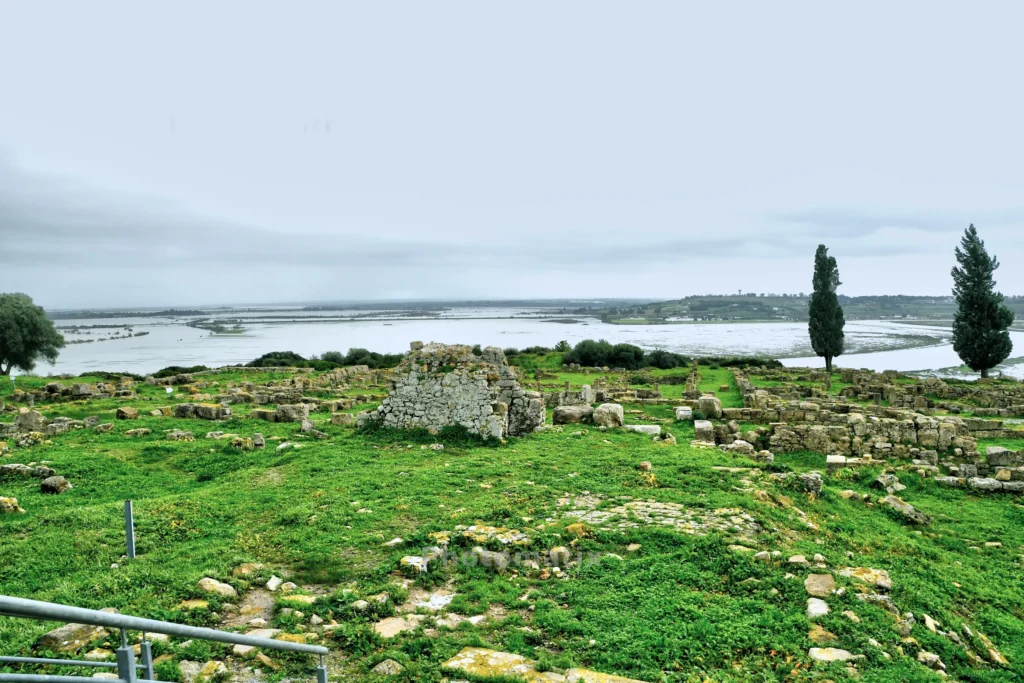
To date, only about ten percent of the site has been archaeologically excavated. However, what is already visible reveals the extraordinary significance of this place. The oldest known settlement layers date back to Phoenician settlements, which emerged as late as the 2nd millennium BC. Their massive, almost megalithic-looking walls differ markedly from later construction phases. Phoenician architecture appears compact and functional – a clear contrast to the subsequent Hellenistic and Roman structures. Lixus reached its greatest extent during the Roman era. Particularly impressive is the prominent location of a monumental palace complex associated with the Numidian-Mauretan kings Juba I and Juba II. From here, one once overlooked the harbor and the trade routes of the western Mediterranean. Muslim communities left their mark as the last cultural phase. However, with changing coastlines and the further decline of sea levels, the economic centre gradually shifted to the present-day location of Larache. The present-day ruins are therefore more than just an archaeological site – they are a geological and cultural-historical archive. Hardly any other place in Morocco illustrates so vividly how closely the course of history is intertwined with changes in climate, coastlines, and trade routes. Since the majority of the city still lies buried, Lixus also remains a promise for future research.
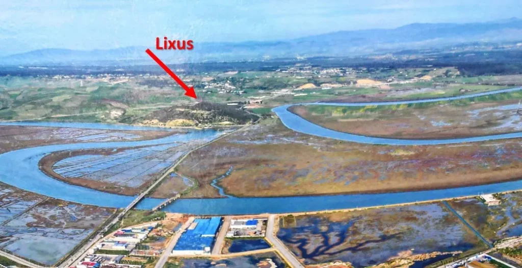
Today, the Loukos River encircles Mount Lixus like an omega. But in ancient times, the entire bay was part of the Atlantic Ocean. At its foot of this peninsula lay a small harbor, which archaeologists only recently discovered.
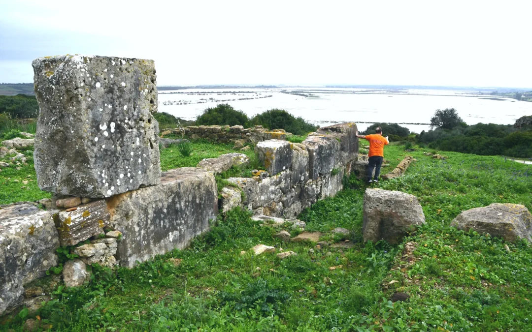
View of the palace of the Numidian-Mauritian kings. At the beginning of the year, torrential rains caused severe flooding in northern Morocco. Since then, the valley has resembled the ancient landscape of the ocean.

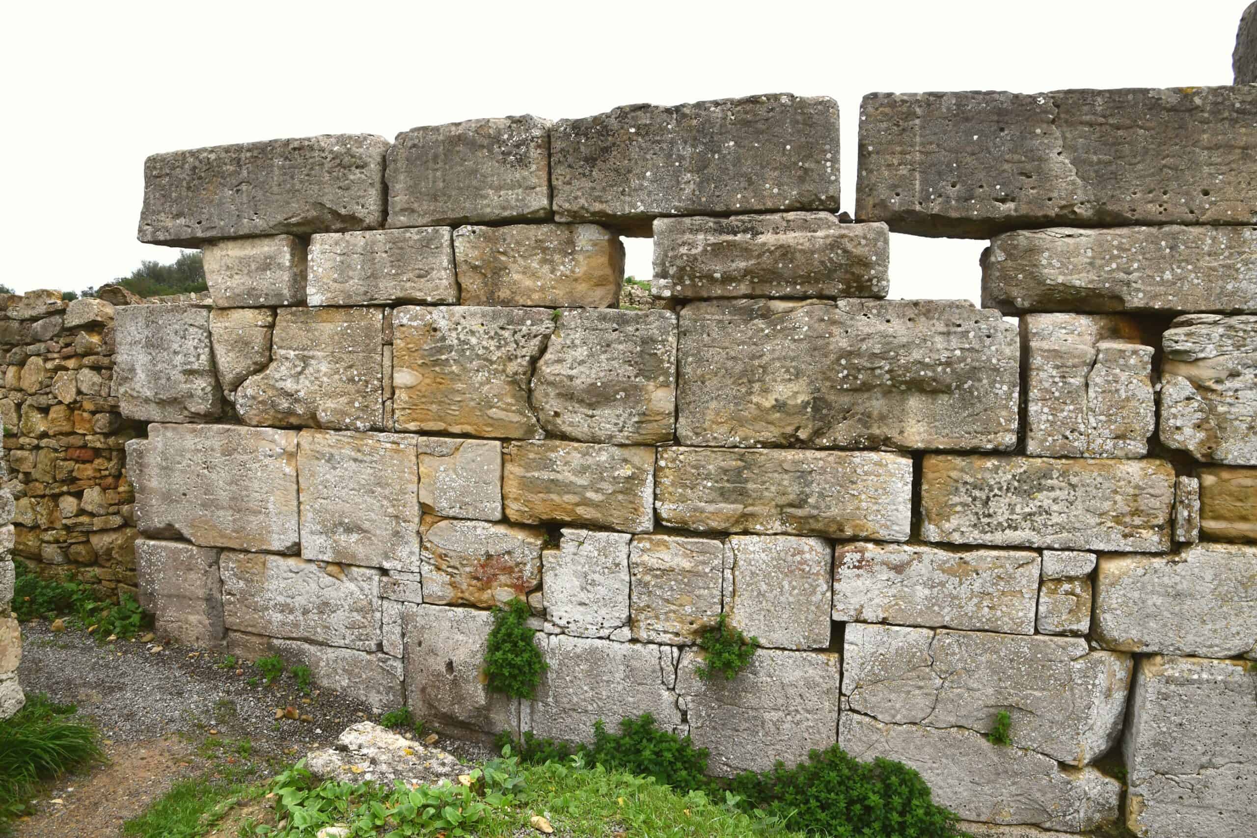
Only a few structures from the earliest settlement have been uncovered so far. This wall demonstrates the distinctive construction methods of the Phoenicians. A cistern of Phoenician origin is also believed to be located underground.
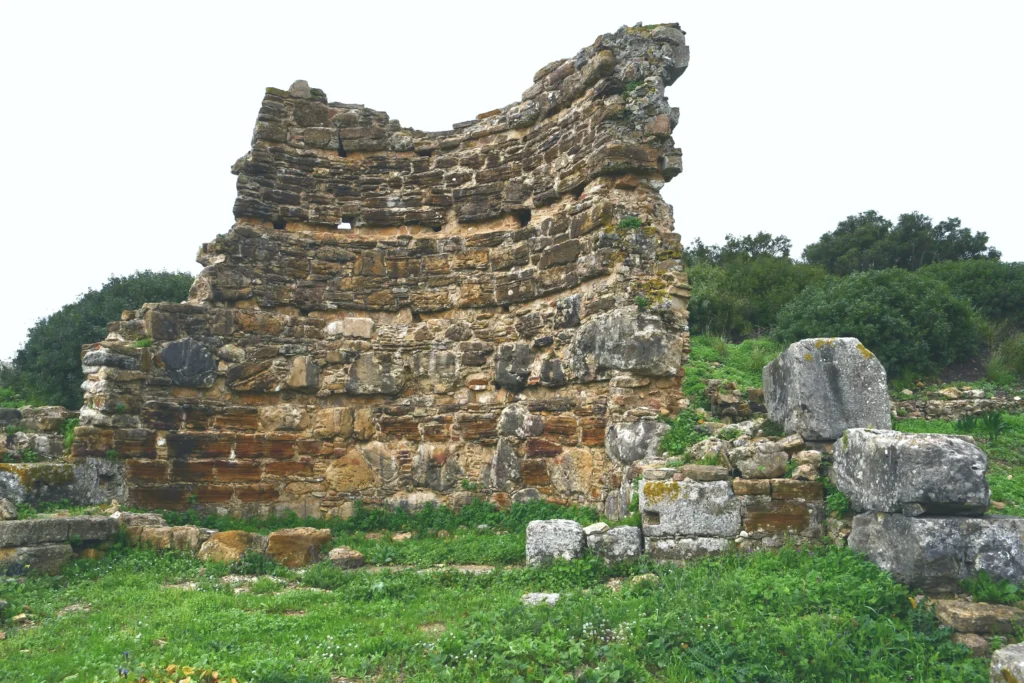
At the end of the wall, the Romans added a basilica. On the right edge, you can see the transition to the much older Phoenician structure. The difference between the two construction methods is clearly visible. The Phoenician wall used no mortar, relying solely on precisely placed large blocks.
Before the Romans, the Greeks also ventured out onto the Atlantic. They too found their way to the Loukos River, where they built a mighty fortress atop the hill. It was eventually taken over by the Romans and integrated into their complex.
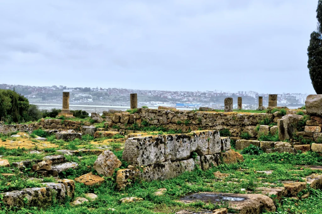
The remains of the royal palace of Kings Juba I & II. They too held Lixus firmly in their grip until environmental conditions changed abruptly. Juba II also undertook an extensive voyage of discovery to explore the lands far to the south of Africa.